0
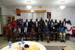
UON STAFF AWARD CEREMONY
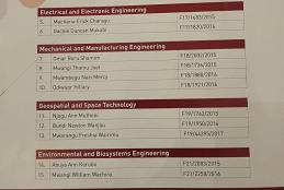
The Department of Medical microbiology and immunology emerged the best department overall in the performance contract for Financial Year 2021/2022 while the Faculty of Business and Management Science emerged the best Faculty; The Directorate of Information and Communication Technology was the best Directorate in Central Units.
The department of Geospatial and Space Technology produced the best two staffs in the faculty of engineering.
- Read more about UON STAFF AWARD CEREMONY
- Log in to post comments
, Prof. Dr.-Ing. Gertrud Schaab (HKA), Prof. Dr.-Ing. Faith Karanja (UoN, Kenya)")