To be a leading centre for the development of knowledge in the…
-
 DEVELOPING MOBILE MAPS APPs IN SUPPORT OF NATURE CONSERVATION
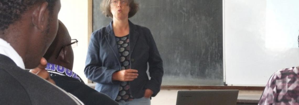
Prof Gertrud Schaab presenting a Seminar on GIS Mobile Map App for Nature Conservation
-


The GIS World day present a showcase of the theme of the year, this year the theme is; Enhancing Food security and…
Countries in the Asia-Pacific (APAC) region are increasingly integrating geospatial data and combining their outputs…
World GIS Day is an annual event that seeks to celebrate Geographic Information Systems (GIS)…
Sunday, June 21, 2020 - 14:00
Mapping the location history of COVID-19 patients is critical in identifying areas that have been exposed to the virus.
Through the use of the geolocation data of positively-tested patients, COVID-19 hotspots can be identified even before cases are confirmed, allowing for early
Latest News & Announcements
Tuesday, July 21, 2026 - 16:16
Tuesday, July 14, 2026 - 12:10
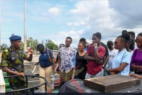
The students began their visit at the Kenya Naval Training College (KNTC), where they were received and taken through a series of presentations at the KNTC debriefing room. The briefings focused on topics related to their course, highlighting the role of geospatial technologies in hydrography,
Read moreThursday, May 14, 2026 - 11:59
Global Background of Act In Space
Act In Space is a global innovation program initiated in
Read moreTuesday, March 17, 2026 - 09:41
Just like in geospatial work, success in sports requires coordination, quick thinking, and determination.
This Sports Week offers a chance to step away from the screens, strengthen connections, and recharge through healthy competition and teamwork.
Featuring:
⚽ Football,