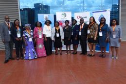
FIRST AI4D AFRICA NATIONAL WORKSHOP
Artificial Intelligence (AI) is the branch of computer science; attempts to make computers that act like humans.
The branches of AI include: Natural Language Understanding, Speech Recognition and Synthesis, Robotics, Multiagent Systems, Knowledge-Based and Expert Systems, Machine Vision, Machine Learning, Pattern Recognition, Planning, Knowledge Representation, and Searching.
- Read more about FIRST AI4D AFRICA NATIONAL WORKSHOP
- Log in to post comments
GIS WEEK NOVEMBER 2022

This event is scheduled to take place on 14th to 16th November at University of Nairobi Towers.
Hundreds of thousands of organizations in every field are using GIS to make maps that communicate, perform analysis, share information, and solve complex problems around the world. This is changing the way the world works and we want to provide an environment to put us ahead of this curve.
The highlights of the three-day event will be:
- Networking sessions with other Students and potential employers
- Read more about GIS WEEK NOVEMBER 2022
- Log in to post comments