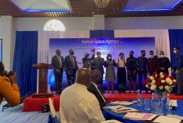
The University of Nairobi wins Kenya Space Agency Research Grant
The Kenya Space Agency (KSA) has announced the winner of the Kenya Space Agency research grant for the FY 2021/2022. This award stems from the research chair programme. KSA set aside Ksh 10 million (USD 89,245) for the award of Research Chairs (RC) for FY 2021/2022. The RCs were for 3U Nanosatellite Model Development, Land Cover Data Collection Application Development and Small-scale Crop Mapping Application using Artificial Intelligence/Machine Learning (AI/ML).


